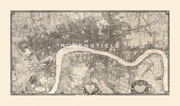
John Rocque Hand Numbered Limited Edition Print on Paper :"Map of London, 1746"
Title: Map of London, 1746
Dimensions (W x H ): Paper Size: 34 x 20 in | Image Size: 30 x 16 in
Edition | Medium: Each print is hand numbered, accompanied by a certificate signed by the Master Printer and is numbered to match the print. The editions are limited to 1880 copies. |
This Gouttelette print on paper is published with light-fast inks to BS1006 Standard onto acid-free calcium carbonate buffered stock, mould-made from 100% cotton and sourced from environmentally conscious paper suppliers. This product is exclusive to Rosenstiels.
About the Art: Superior Edition
About the Artist:
John Rocque, originally known as Jean, was born in approximately 1709 and died in 1762.
He was a noted surveyor and cartographer of the early 18th century and moved as a very young child to England with his parents, who were French Huguenot émigrés.
Rocque carved out a highly successful career as a surveyor, mapmaker, engraver and map-seller. He also designed gardens and produced engraved plans of several of these, including those at Painshill Park in Surrey and Wilton House near Salisbury.
Rocque is mainly known now though for his maps, including a famous one of London, which was the most detailed published up to that time, and his maps of Ireland, including his 1756 map of Dublin. So successful was he that he was appointed Cartographer to the Prince of Wales in 1751.
Little is known of Rocque’s personal life, though he was apparently married twice. His monumental wall map of Ireland was published after his death in 1794 and covers Ireland with remarkable detail, noting every known town, hamlet, bishopric, forest, country, castle and road. The map was published by Laurie & Whittle in the 1797 edition of Thomas Kitchin’s General Atlas.


