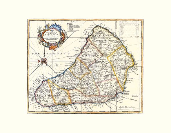
Emanuel Bowen Hand Numbered Limited Edition Print on Paper :"Map Of Barbados"
Title: Map Of Barbados
Dimensions (W x H ): Paper Size: 36 x 28 in | Image Size: 36 x 28 in
Edition | Medium: Each print is hand numbered, accompanied by a certificate signed by the Master Printer and is numbered to match the print. The editions are limited to 1880 copies. |
This Gouttelette print on paper is published with light-fast inks to BS1006 Standard onto acid-free calcium carbonate buffered stock, mould-made from 100% cotton and sourced from environmentally conscious paper suppliers. This product is exclusive to Rosenstiels.
About the Art: Superior Edition
About the Artist:
Emanuel Bowen was a prolific English mapmaker of the 18th century.
Perhaps his most famous work was The Large English Atlas, published in 1755 with Thomas Kitchin, illustrating 45 detailed maps of England. Combining cartographic detail with descriptive annotations, each engraving showed an enormous amount of information to a scale which had not previously been attempted within an atlas.
Bowen also produced good quality world atlases, and was one of the leading cartographers in an English mapmaking tradition which extended from around 1700. Many of the maps in his atlases were based on those produced by international contemporaries and his atlases included an excellent range of maps of British-held territories around the world, including islands in the Caribbean.
Other famous atlases with which Bowen was involved include A Complete System of Geography (1744-1747) and A Complete Atlas or District View of the Known World (1752).
As with all great mapmakers, Bowen’s maps were copied and re-issued by later publishers; one rare Dutch edition of his maps was published in Amsterdam in 1785 by William Bachienne.
Bowen was born in approximately 1698 and died in 1767.


